Chilling satellite images that show the impact of war from space
The impact of wars and conflicts seen from space
Even long after a war is over, sometimes the evidence and destruction it caused can still be seen from space. Over the years, our planet has seen many wars and conflicts, and astronauts aboard the International Space Station, as well as satellites orbiting Earth, have managed to capture some of their impact on the ground below.
Here’s a look at some of the images that show the destruction left behind by war.
Image of 9/11 attacks taken from ISS (2001)
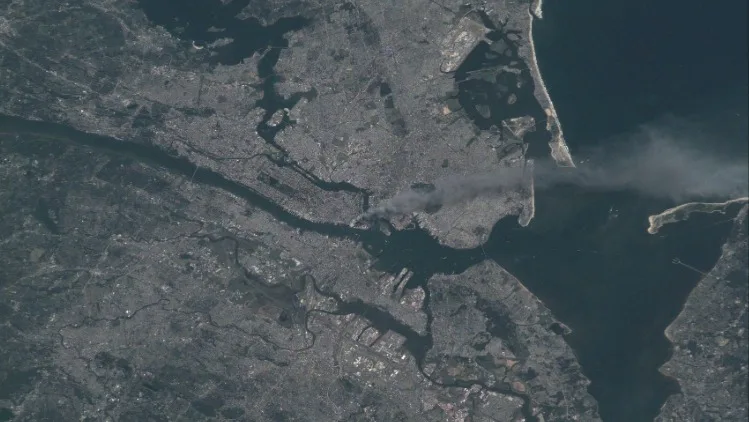
NASA astronaut and ISS commander Frank Culbertson clicked this image when he was passing over New York City shortly after getting the news of the attack. In this image, you can see the thick smoke blowing away from the surface.
And if you look closely, you will also notice an 'odd boom', which shows that this image was taken "around the time of, or shortly after, the collapse of the second tower," Culbertson said.
Israel and Gaza from space (2014)
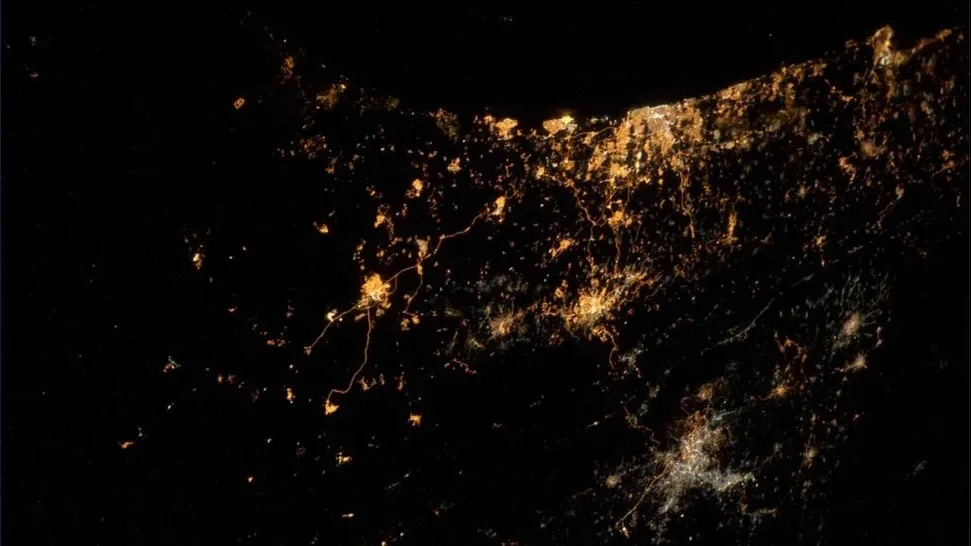
This image was taken on July 23, 2014, and shows rockets and explosions over the Gaza Strip and Israel. ESA astronaut Alexander Gerst, who was aboard the International Space Station at the time, captured the image and shared it on his X account, writing that it’s his “saddest photo yet.”
Commenting on this image, he wrote in his blog post, "What came to my mind at the time of this photo was, if we ever will be visited by another species from somewhere in the universe, how would we explain to them what they might see as the very first thing when they look at our planet?...I do not have an answer for that."
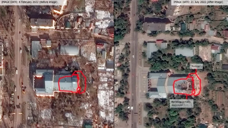
Ukraine cultural damage during Russia’s invasion (2022)
The United Nations compared images taken before and after the attacks to identify sites that had been damaged. As reported by The Guardian, an initial assessment found damage at 207 cultural sites, and this includes a total of 88 religious sites, 15 museums, 76 buildings of historical or artistic interest, 18 monuments, as well as 10 libraries from across the country.
“Our conclusion is it’s bad, and it may continue to get even worse,” UNESCO’s cultural and emergencies director Krista Pikkat noted, adding that “cultural heritage is very often collateral damage during wars, but sometimes it’s specifically targeted as it’s the essence of the identity of countries.”
Russian invasion of Ukraine (2022)
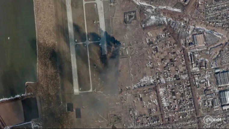
Here's a look at the Chuhuiv Airbase, Ukraine, captured on February 24, 2022. This image was taken by Planet (formerly Planet Labs), which is a U.S.-based company that operates over 200 Earth-observing satellites. This one was taken on the same day when reports allege that a Russian missile struck the base.
"Sad to see the tragic and deteriorating events in Ukraine. We have and will continue to provide imagery from the region to our partners, aid, relief and human rights organizations, and the media to expose the situation as events unfold. Our thoughts are with the people of [Ukraine]," Planet wrote while sharing the images on X.
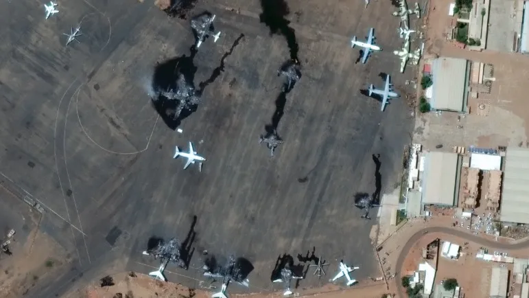
Damage from violent clashes in Sudan (2023)
Maxar Technologies posted this image on April 17, 2023, to show the damage caused at Sudan's Khartoum International Airport due to conflict that occurred in the country.
As per Space.com, the conflict grew due to the power struggle between the army and the paramilitary Rapid Support Forces (RSF) on April 15, and it soon turned violent. At least 14 airplanes were reported to be destroyed.
Iraqi missile facility before and after airstrikes (2003)
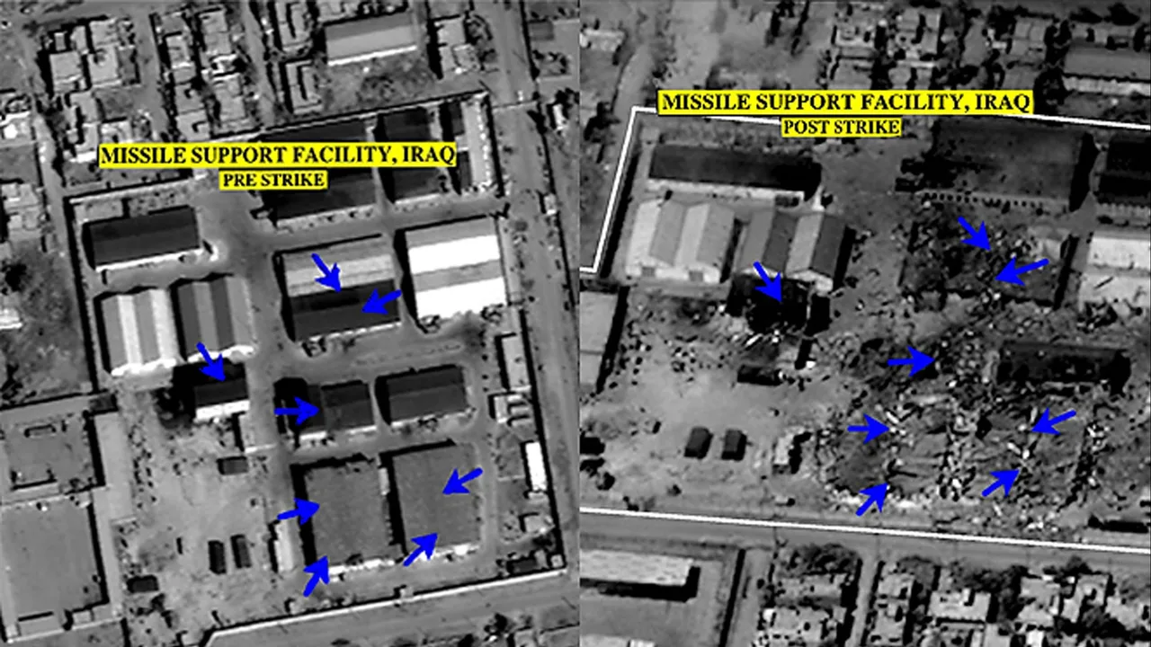
Another example of satellite imagery being used to show the effects of conflict came during the Iraq War in 2003. These images were released by the U.S. military's Central Command on March 27, 2003. Here, you can see an Iraqi missile support facility before and after it was hit by airstrikes.
The images give us a clear view of the damage caused to the buildings. At the time, Brigadier General Vincent Brooks said that the U.S. military would continue to target what it described as legitimate Iraqi targets.
Effects of bombing Mili Island (1943 to 1945)
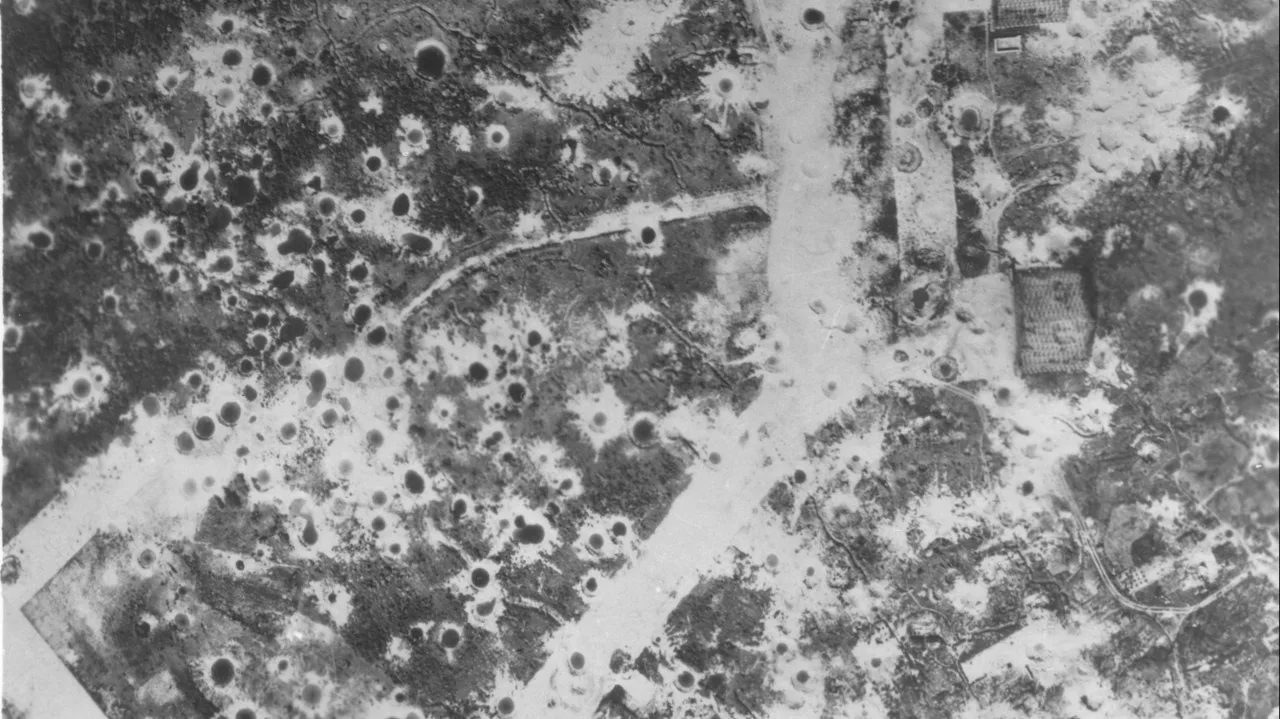
This aerial view gives us an idea of just how intense the bombing of Mili Island had become during World War II. The surrounding landscape here is covered with craters left behind by exploding bombs.
The island had faced almost constant attacks by the U.S. Marine Corps aircraft for around 18 months. And by the time Japanese forces on Mili surrendered in late August 1945, the repeated bombing had left visible marks across the island.
Fortification patterns on the Iraq-Iran border (2014)
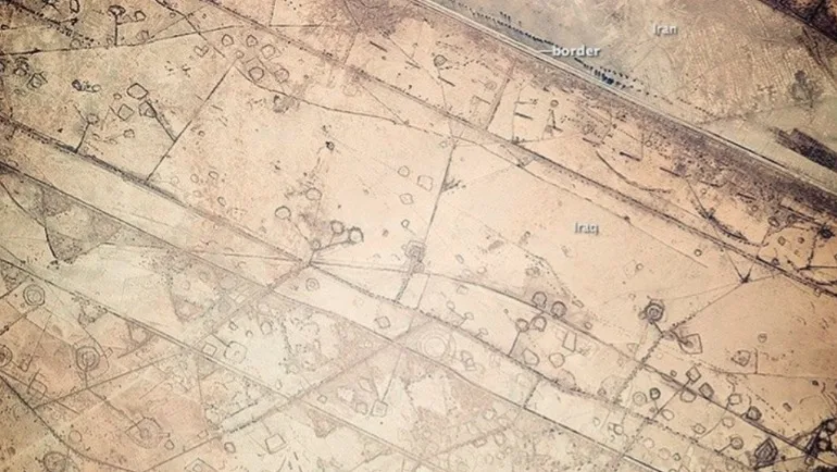
In another image shared by an astronaut aboard the International Space Station, you can see the destruction caused by the numerous military actions during the war in the 1980s.
Here, the earthworks may look like oil pads from above, but these are "patterns of military fortifications," as per NASA. This image above was taken on November 07, 2014.
Population shifts in Ukraine during the Russia-Ukraine war (2022)
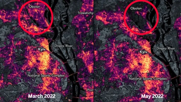
Scientists from NASA’s Goddard Space Flight Center (GSFC) and the Universities Space Research Association (USRA) have worked together to observe the changes in light with the help of the nighttime sensing capabilities of NASA NOAA satellites. Here, the reduction in light shows that people have moved closer to the capital in a span of a few months due to the conflict.
“These data show us one dimension of how the impacts of the conflict have been distributed within Ukraine,” said Eleanor Stokes, a USRA scientist and co-leader of the Black Marble Project. She added that it’s data like this that make sure humanitarian agencies can provide help to those who have lost access to basic services.