NASA-ISRO’s NISAR satellites captures stunning ‘hummingbird’ feature in Antarctica

The joint NASA-ISRO NISAR satellite has revealed a stunning geographical feature in Antarctica which is otherwise invisible. Captured by the satellite’s L-band instrument in August 2025, the image shows Nunatak Zaterjavshijsja, a mountaintop in East Antarctica, highlighting the movement of the glacier and what’s happening beneath the surface.
A hummingbird in Antarctica?
— NASA JPL (@NASAJPL) July 21, 2026
This striking image, taken by the NISAR satellite, is actually a mountaintop surrounded by flowing, fractured ice. Radar reveals features at and beneath the surface that ordinary images can miss. More: https://t.co/LKEhWQG57f pic.twitter.com/xlfLdp4WW9
“It’s a beautiful image, with rich details of features that provide insights to how the glacier is moving,” Seongsu Jeong, the signal analysis engineer who produced the image at NASA’s Jet Propulsion Laboratory, said in a statement. “Because radar can often see through snow and deep into the ice, NISAR can observe fundamentally different properties of Antarctic ice than can be seen in optical imagery. With NISAR we’re seeing what’s hidden beneath the surface.”
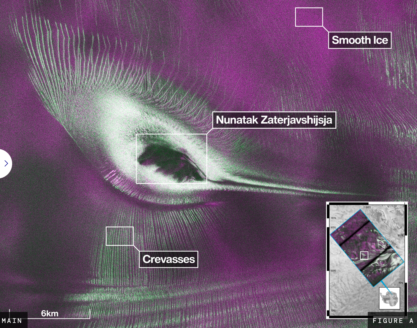
The mountain peak in the picture resembles a hummingbird, and the colors represent differences in the way polarized microwave signals, which vibrate in different directions, interact with and reflect from the ice. Magenta represents signals that come back with a horizontal polarization after bouncing off regular surfaces, such as smooth ice, whereas green represents signals returning vertically after partially penetrating the snow and ice and scattering at different angles from irregular surfaces such as the crevasses—cracks in the ice visible as sharp green lines.
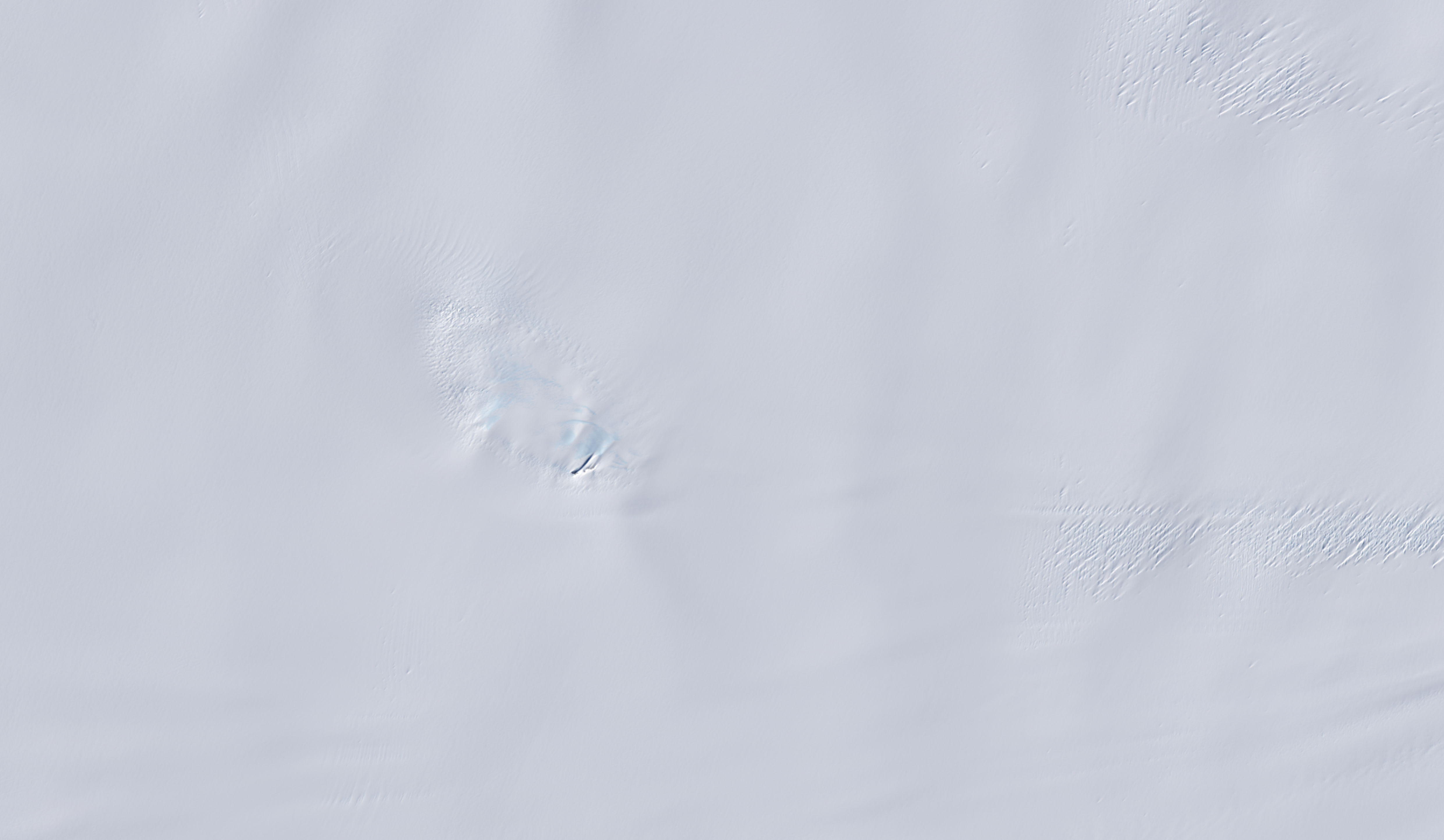
When viewed in optical light, the same area is almost entirely white, which showcases NISAR's capability to penetrate surfaces for extensive mapping. It was able to capture greater detail in this region because microwaves from NISAR’s L-band radar can penetrate frozen surfaces better than optical satellites relying on infrared and visible light.

NISAR was launched on July 30, 2025, and it’s the world’s first satellite to carry two different radar frequencies—L-band and S-band. Built at a cost of $1.5 billion, the spacecraft is installed in a near-polar, sun-synchronous orbit at an altitude of approximately 747 km (464 miles), allowing it to monitor nearly all of Earth's land and ice-covered surfaces twice every 12 days. NASA says that since its launch, NISAR has extensively captured imagery of urban street grids, agricultural fields, landslides, earthquakes, and sinking land in Mexico City. According to ISRO, NISAR’s primary objectives are to study land and ice deformation, land ecosystems, and oceanic regions to help scientists better understand our planet's processes and changing climate, as well as to aid future resource and hazard management.
More on Starlust:
What are gamma-ray bursts? Scientists make milestone findings on cosmos' most energetic events
Scientists discover nearby super-Earth is leaking helium into space, revealing its atmosphere