Mars exploration: HRSC principal investigator explains how the camera helps identify safe landing sites
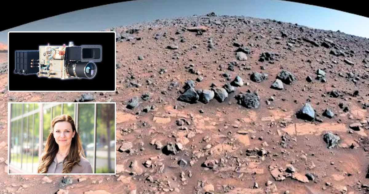
The High Resolution Stereo Camera (HRSC) onboard the ESA’s Mars Express has released new images that provide a fascinating view of the heavily pockmarked region of Arabia Terra, with a special focus on the Trouvelot Crater and its neighbors. Dr. Daniela Tirsch, HRSC principal investigator and researcher at the German Aerospace Center, interacted exclusively with Starlust, sharing how the camera experiment gives insight into the past water activity of the planet and could help shape future Mars missions.
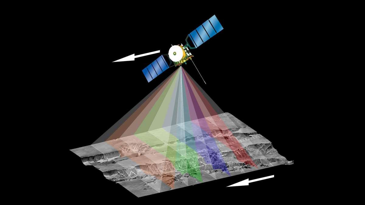
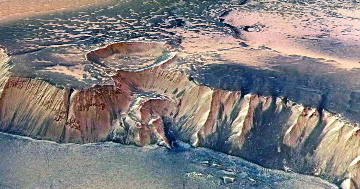
Developed by the German Aerospace Center (Deutsches Zentrum für Luft- und Raumfahrt; DLR) for the Express mission, HRSC has been sharing images of Mars since 2004. The latest images of the Arabia Terra landscape, which is over 3.7 to 4.1 billion years old, were generated from the camera's digital terrain model and the nadir and color channels, showing the glut of craters scattered across the region. The Trouvelot Crater, which is the highlight of the images, is huge with a width of 149 kilometers. It's also ancient, with its antiquity evident in its terraced walls that form when the walls of craters measuring more than 100 kilometers in diameter become unstable over time, collapsing under their own weight. The floor of the crater is covered with sand dunes composed of dark material that are volcanic in origin and are rich in magnesium and iron. The most interesting feature, however, is a 20-kilometer-long and 270-meter-high bright hill, also located on the floor.
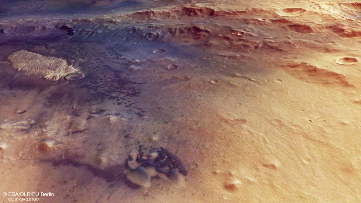
The German Aerospace Center notes that these mounds, which have a much higher reflectance than their surroundings, are often a sign of minerals that were formed in the presence of water. Spectroscopic studies hint at the presence of clay and sulphur-bearing minerals, both of which owe their formation to weathering processes involving water. Bright mounds like this may have formed from the sedimentary deposits in the erstwhile crater lakes and had furrows carved into them by wind erosion after the water disappeared. "Evidence from many Mars missions shows that early Mars hosted stable lakes and rivers, as well as groundwater systems," Dr. Tirch told Starlust in an email. "At the same time, water activity on Mars likely occurred episodically and periodically, depending on climate conditions and local geological processes. Observations from Mars Express contribute to this overall picture by revealing landforms and mineral deposits that indicate both surface water and groundwater activity in the planet’s past."
The HRSC is also an important tool in the evaluation of potential landing sites for both crewed and rover missions. "High-resolution mapping from HRSC helps mission planners assess both scientific potential and landing safety," Dr. Tirsch explained. "In regions such as Arabia Terra, HRSC data can help identify sedimentary deposits or hydrated minerals—important targets for studying past water and potential habitability." The HRSC data also allows for the assessment of surface roughness, slopes, and hazards that may derail landing attempts, in addition to revealing "stratigraphic layers in crater walls and mounds that may preserve records of Mars’ climate history and highlight locations where water-related processes and impact geology intersect."
The HRSC has enabled researchers to deep dive into the evolutionary history of Mars, equipping them with crucial insights for future missions. As new discoveries unfold, various intriguing sites will open up for exploration, furthering our understanding of the planet and setting the stage for future Martian missions.
More on Starlust
NASA's Perseverance rover successfully completes first AI-directed drive on Mars
Mars may be tiny but its impact on Earth's ice ages has been immense