NASA's Perseverance rover sends selfie from the Martian 'Wild West' — here's why it's special
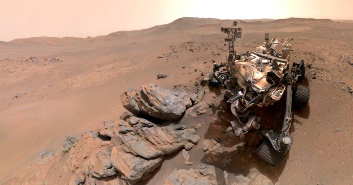
NASA's Jet Propulsion Laboratory has shared a selfie sent by the Perseverance rover from Mars, which was taken on March 11, 2026. The portrait is a composite of 61 images and is part of a sequence of images that show the rover after having ground down a rock for scientific study on Sol 1797 of the mission (a sol is a day on Mars), with the ancient Martian terrain in the background. The image was taken over the duration of about an hour with 62 movements of the rover's robotic arm.
Perseverance in the Wild Martian West 🤠
— NASA (@NASA) May 12, 2026
Our Perseverance Mars rover snapped some photos beyond the western rim of Jezero Crater—the farthest west the rover has ever gone on the Red Planet. See what we found there: https://t.co/nIkwxstE26 pic.twitter.com/6gJ9xgnVy5
NASA's latest Mars rover is currently farther west of its landing site at Jezero Crater than it has ever been. Its current location—a region called by the science team "Lac de Charmes"—contains some of the most scientifically intriguing terrain the rover has ever visited. Project Scientist Katie Stack Morgan of JPL referred to the region as the "Wild West." Speaking of the self-portrait that the rover took with the WATSON (Wide Angle Topographic Sensor for Operations and eNgineering), she stated, "We had just abraded and analyzed the 'Arathusa' outcrop, and the rover was sitting in a spot that provided a great view of both the Jezero Rim and the local terrain outside of the crater." Selfies, as simple as they may sound, are rare for Perseverance. Since its mission commenced on February 18, 2021, the rover has only taken six, including this one.
The aforementioned abrasion patch is how the rover examines what makes up Martian rocks from the inside. During the process, the rover ground down a circular portion of the surface of the rock. This technique is what allowed scientists to determine that the Arathusa outcrop is made of igneous rocks that have existed since before the Jezero Crater.
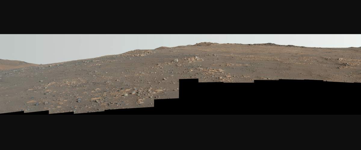
Perseverance also helped teams on the ground capture another picture in the form of a mosaic of the "Arbot" region in Lac de Charmes. This panoramic view was taken on Sol 1882, or April 5, 2026, and is a composite of 46 photographs of a landscape believed to be rich in geological treasures for scientists. In what is perhaps an even more significant image than the selfie mentioned above, the image appears to contain megabreccia. These are large, often skyscraper-sized rocks that were chucked across when a large meteorite impacted the Martian plain of Isidis Planitia roughly 3.9 billion years ago. "What I see in this image is excellent exposure of likely the oldest rocks we are going to investigate during this mission," said Ken Farley, Perseverance’s deputy project scientist at Caltech in Pasadena, California. Such is the difference in the characteristics of these rocks from the sedimentary rocks found near the rover's landing site that scientists are able to peer into the early days of the Martian crust.
These findings will go a long way in understanding the conditions that were present before the red planet was suspected to bear life. "These rocks—especially if they’re from deep in the crust—could give us insights applicable to the entire planet, like whether there was a magma ocean on Mars and what initial conditions eventually made it a habitable planet", said Stack Morgan. Once the rover is finished observing the Arbot area as part of its fifth science Northern Rim campaign, it will then move on to the "Gardevarri" site. This is expected to lend even more context to the volcanism and ancient geology of Mars.
More on Starlust
Humans can make a round trip to Mars within 153 days, new study reveals