Astronauts
Astronomy
Constellation
Deep Sky Objects
Moon
Stargazing
Telescope
About Us Contact Us Privacy Policy Accuracy & Corrections Terms & Condition
COPYRIGHT. All contents of on the site comporting the StarLust branding are Copyright 2019. All rights reserved.
STARLUST.ORG / DEEP SKY OBJECTS

NASA and French satellite capture massive river waves in groundbreaking discovery

A joint NASA and CNES satellite uses its advanced Ka-band Radar Interferometer (KaRIn) to precisely map the height of nearly all surface water on Earth.
PUBLISHED MAY 26, 2025
This illustration depicts the Surface Water and Ocean Topography (SWOT) satellite with solar arrays fully deployed (Representative Cover Image Source: NASA Image and Video Library | NASA)

For the first time, scientists from NASA and Virginia Tech utilized satellite data to gauge the height and speed of potentially dangerous flood waves in US rivers. They successfully tracked three such waves, likely resulting from extreme rainfall and a dislodged ice jam, per NASA

The international Surface Water and Ocean Topography (SWOT) satellite is shown in orbit over Earth in this illustration (Image Source: NASA Image and Video Library | NASA)
The international Surface Water and Ocean Topography (SWOT) satellite is shown in orbit over Earth in this illustration (Representative Image Source: NASA Image and Video Library | NASA)

While a comprehensive database of satellite data on river flood waves doesn't yet exist, this new research highlights the immense potential of space-based observations to aid hydrologists and engineers, especially those in communities along river systems, with limited flood control infrastructure like levees and floodgates. Unlike typical ocean waves, which are driven by wind and tides and maintain a consistent pace, river waves (also known as flood or flow waves) are transient surges that can span tens to hundreds of miles. Usually triggered by rainfall or seasonal snowmelt, these waves play a vital role in transporting nutrients and organisms downstream. However, they can also pose significant risks, as "extreme river waves triggered by a prolonged downpour or dam break can produce floods." 

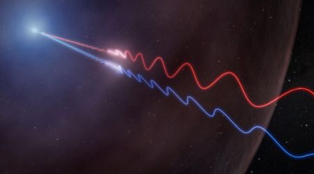
Cedric David, a hydrologist at NASA’s Jet Propulsion Laboratory in Southern California, and a coauthor of a new study, published May 14 in Geophysical Research Letters, said, “Ocean waves are well known from surfing and sailing, but rivers are the arteries of the planet. We want to understand their dynamics.” For her doctoral research, lead author Hana Thurman of Virginia Tech utilized data from the SWOT (Surface Water and Ocean Topography) satellite, launched in 2022, to identify river waves. This satellite, a joint effort by NASA and the French space agency CNES (Centre National d’Études Spatiales), meticulously surveys the height of nearly all surface water on Earth, both fresh and saltwater, using its highly sensitive Ka-band Radar Interferometer (KaRIn). The KaRIn instrument functions by bouncing microwaves off water surfaces and measuring the return time, thereby mapping the elevation and width of water bodies. 

Members of the international Surface Water and Ocean Topography (SWOT) mission test one of the antennas for the Ka-band Radar Interferometer (KaRIn) instrument (Image Source: NASA Image and Video Library | NASA)

Nadya Vinogradova Shiffer, a SWOT program scientist at NASA Headquarters in Washington, explained that beyond simply "monitoring total storage of waters in lakes and rivers, we zoom in on dynamics and impacts of water movement and change.” Thurman was aware that SWOT had already assisted scientists in tracking rising sea levels along the coast, identifying tsunami slosh, and even mapping the seafloor, but her key question was whether it could also pinpoint river height irregularities that signal a moving wave, as mentioned on NASA's official website. 

A herd of bison grazes along the Yellowstone River in Hayden Valley (Image Source: Getty | George Rose)

Thurman's research revealed that the mission successfully captured three distinct instances of river waves. One notable example arose abruptly on the Yellowstone River in Montana in April 2023. When the satellite flew overhead, it observed a wave with a 9.1-foot-tall crest flowing toward the Missouri River in North Dakota, characterized by a dramatic 6.8-mile-long peak followed by a more drawn‐out tail. Thurman was impressed, noting that these "details are exciting to see from orbit and illustrate the KaRIn instrument’s uniquely high spatial resolution." Thurman added, “We’re learning more about the shape and speed of flow waves, and how they change along long stretches of river.” Furthermore, Thurman shared, “That could help us answer questions like, how fast could a flood get here, and is infrastructure at risk?”

MORE ON STAR LUST
The NASA/ESA Hubble Space Telescope recently captured an image of the spiral galaxy IC 758, located 60 million light-years away in the constellation Ursa Major.
1 day ago
The Nancy Grace Roman Space Telescope, launching in 2027, will use gravitational lensing, a phenomenon Einstein predicted over a century ago, to study the mystery of dark matter.
1 day ago
Essential for galactic evolution, mergers impact the layout of gas, the motion of stars, and a galaxy's overall structure, ultimately leading to greater stellar mass.
2 days ago
Scientists are shedding new light on Cosmic Noon, a crucial era 10 to 12 billion years in the past when stars formed at rates 10 to 100 times greater than what we see now.
2 days ago
Climate change has amplified wildfires across Canada and the western US.
3 days ago
By the night of June 19, Mars officially entered the Spring Triangle, and it'll continue to skim its lower edge until mid-September.
4 days ago
Looking ahead, this costly dilemma is expected to intensify dramatically, with the number of satellites in orbit predicted to surge to tens of thousands in just a few years.
Jun 15, 2025
This ambitious project, spearheaded by ADA Space and Zhejiang Lab, plans to deploy a vast network of 2,800 satellites.
Jun 15, 2025
Satellite operators that function under the American government are signing massive international deals to support foreign space markets.
Jun 15, 2025
These data are crucial for scientists to understand the Sun's cyclical activity, specifically how it shifts between intense and quieter phases.
Jun 14, 2025
The astronauts who witnessed the unique sight from space said that they perceived it to be some kind of colorful cloud cluster.
Jun 14, 2025
Blue Origin CEO Dave Limp stated that a primary mission objective is to successfully land and recover the booster.
Jun 14, 2025
The delay is due to the detection of a 'new pressure signature' in the Zvezda service module, a part of the station.
Jun 13, 2025
A year ago, Boeing’s Starliner spacecraft docked with the ISS, and a year later, its next flight is still delayed, as per NASA.
Jun 13, 2025
Dark locations and temperate environments will allow people on Earth to witness the Milky Way in its best element this month.
Jun 12, 2025
SpaceX announced on June 10 (EDT) that the delay is due to a liquid oxygen (LOx) leak found during booster inspections after a static fire test.
Jun 12, 2025
The largest map of the universe was created as part of a scientific collaboration that cataloged an array of galaxies in the cosmos.
Jun 11, 2025
Astronauts use a small, tethered doll as a zero-gravity indicator; when it floats freely, it signals the crew has safely reached low Earth orbit.
Jun 11, 2025
The Ax-4 mission is Axiom Space's fourth crewed trip to the ISS and will use a brand-new SpaceX Crew Dragon capsule on its very first flight.
Jun 10, 2025
The Kuiper 2 mission will launch 27 Amazon internet satellites on a ULA Atlas V rocket from Cape Canaveral, Florida, on Friday, June 13, at 2:29 p.m. EDT.
Jun 10, 2025