How far away in space must an astronaut be to view Earth in its entirety

So far, the Apollo mission images have only captured the planet as a whole, rather than just parts.
An astronaut conducting a spacewalk in Earth orbit. 3D Illustration. Some elements of this image were furnished by NASA (Representative Cover Image Source: Getty Images | NiseriN)

Astronauts on space missions and satellite grabs in orbit have supplied some of the most breathtaking views of our home planet from the cosmos. However, be it from a space shuttle, the space station, or the satellites, one does wonder at what distance an astronaut can enjoy Earth’s beauty in its entirety. According to BBC Sky at Night Magazine, the distance is considerably larger than one assumes. So far, the Apollo mission images captured the planet in its entirety, considering it was taken from the moon at a distance of 230,000 miles from the planet.

The whole Earth from space, viewed from Apollo 17, December 1972. This was the first photograph of the south polar ice cap. Credit: ARPL/NASA. (Photo by Ann Ronan Pictures/Print Collector/Getty Images)

The images that have been captured to date relied on the area and angle, revealing vivid details of various parts of the planet. It showed outlines of lakes, rivers, mountains, and cities or the entirety of the blue planet set against the darkness of space. However, what is the exact distance between Earth and an astronaut at which the whole planet falls in sight? In ascending order, 200 miles above the coordinates 52ºN 0ºW, majorly Europe is seen, and 600 miles shows a less detailed northern Africa. At a distance of 22,000 miles, the whole of Earth is visible, per the report.

Detailed image of the Earth and the surface of the moon from the view of the lunar surface in space. (Photo by John M Lund Photography Inc / Getty Images)

This altitude is the location of a geostationary satellite. This is a satellite that seems static, though it revolves around the equator. To capture the whole Earth in a globe, three such satellites are required. To consider the difference in details captured in images, one only needs to compare the distance between the planet and the vessel. The International Space Station orbits Earth more closely, at a distance of around 250 miles, reported NASA. This is the reason that images captured from the space station have many more intricacies compared to other satellites further away.

Image of the International Space Station orbitting the earth as it circles around the planet. (Photo by Matthias Kulka / Getty Images)

Recently, the number of images captured by astronauts that hold the entire planet in a frame has decreased. This is because present manned space flights remain in the Low Earth Orbit (LEO), either at the ISS or at the Chinese space station (Tiangong 2). At this altitude, one can see the curvature of the Earth, but not the entire globe. Once astronauts begin to leave the LEO again, this will change. Missions in the 60s and 70s went beyond the orbit of the Earth, which allowed them to see our planet as a whole disk.

12 April 1969, International day of human space flight, Cosmonautics Day concept with ISS astronaut in spacesuit against background of the Earth planet. A spaceman in outer space. (Photo by quantic69 / Getty Images)

The beginning of seeing Earth as an entire disk was from the Apollo missions that began with Apollo 8. However, even this does not capture the entire disk due to the phase of the moon and half of Earth covered in darkness, as shown by NASA. In the image, one can see the entirety of the Western Hemisphere from the moon. It was noted that due to the angle of the Earth, the moon, and the sun, every image taken during the Apollo 8 showed only a ‘partially illuminated Earth.’ This situation reportedly continued through the following Apollo mission, except for Apollo 17.

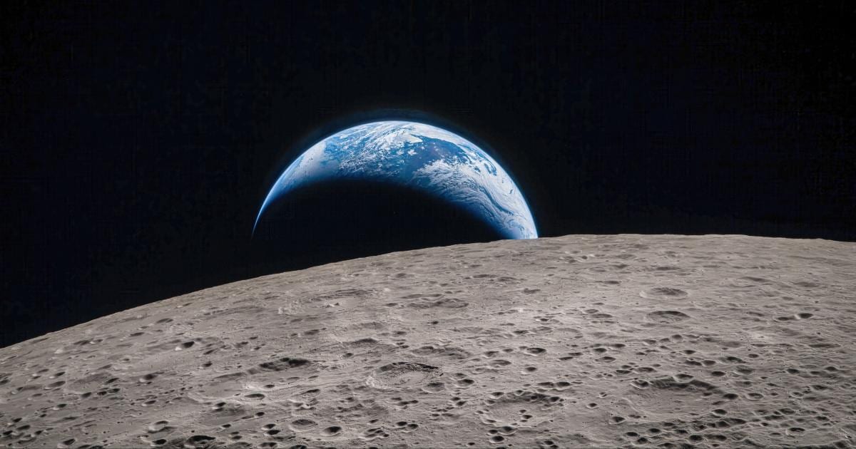
The Earth rises over the horizon of the Moon, as seen during the Apollo 11 lunar landing mission, July 1969. The centre of the image is located at 85 degrees east longitude and 3 degrees north latitude. (Photo by Space Frontiers/Getty Images)

If one wishes to experiment with the spatial view of Earth, they can do so while using a commonly used application, Google Earth. It helps you zoom out from ground level. It displays the distance at which you are zoomed out in the image as well. This is more useful to learn about the view that is seen by our astronauts on the space station right now. 
MORE STORIES

From the marked improvement in the heat shield performance of the Artemis II Orion spacecraft over its predecessor to an update related to a privately funded space telescope, news from the week gone by provides a glimpse into the future of space exploration.
4 hours ago
While we knew the Moon was shrinking, the rate of contraction had not been known until now.
5 hours ago
Researchers have shed light on the origins of a mysterious treble clef-shaped radio structure lurking behind the Milky Way.
1 day ago
A new study reveals that the outer solar system's doomsday maybe much closer than previously believed due to Sun's "stochastic kicks."
2 days ago
The spectra obtained by NASA's SPHEREx revealed signatures of water, methane, carbon monoxide, and carbon dioxide.
4 days ago
NASA's lunar ambitions edging towards concrete reality, reusable rockets built across the Atlantic and more.
7 days ago
The elusive burst came from a time when the universe was about 3 billion years old and it originated from a very small galaxy.
7 days ago
Despite some difference between how the cloud behaved in reality and what simulations showed, scientists still said that “the result is remarkable".
Oct 8, 2026
ESA’s Hera is preparing for a key braking maneuver as it closes in on Didymos and Dimorphos.
Oct 8, 2026