NASA’s Mars Orbiter hits historic 100,000-image mark thanks to its HiRISE camera
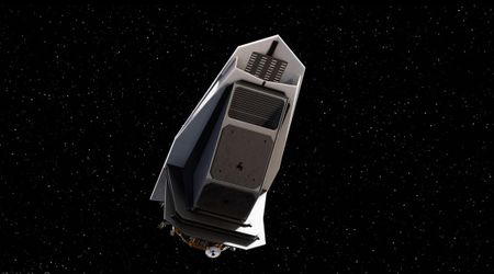
In 2005, when an Atlas V Rocket took off from the Cape Canaveral Air Force Station in Florida, it carried along with it the Mars Reconnaissance Orbiter (MRO), one of NASA's most ambitious missions aimed at understanding the Red Planet better. It took the MRO seven months to finally enter the Mars orbit in March of 2006, per NASA. Since then, it’s been quietly doing amazing work, snapping numerous images with its super-sharp HiRISE (High Resolution Imaging Experiment) camera. Those images have helped scientists get insights into the planet's weather and geology. Now, almost twenty years later, MRO just hit a huge milestone with its 100,000th photo.

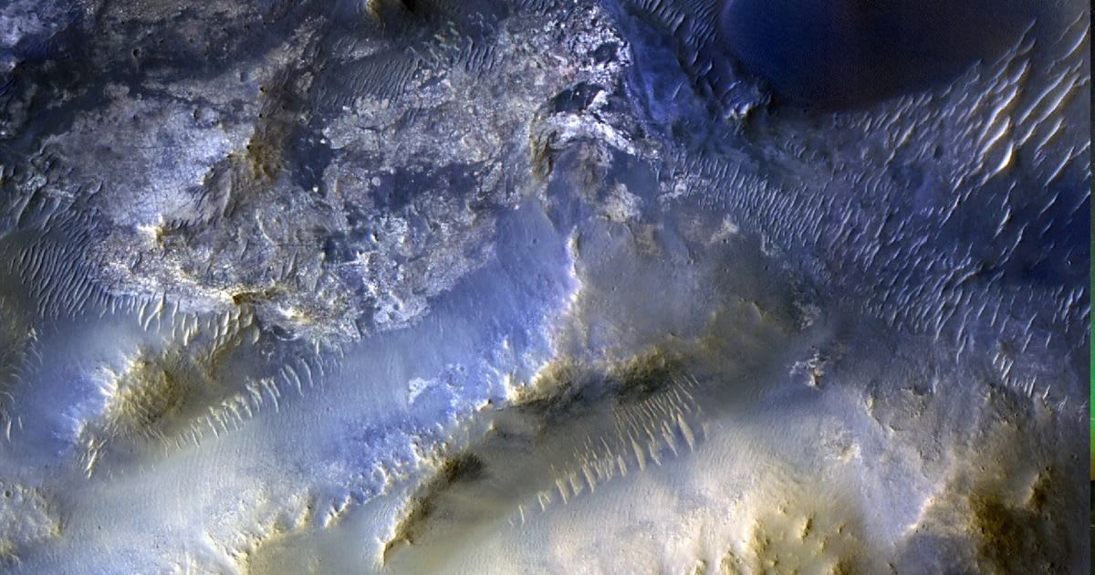
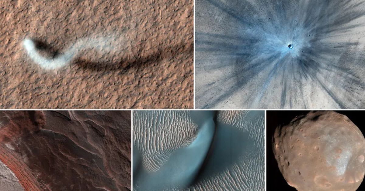
The image that was captured on October 7 shows the mesas and dunes within the Syrtis Major. The Syrtis Major region lies around 50 miles away from the Jezero Crater, which is being explored by NASA's Perseverance Rover. At the heart of the image, broad mesas rise like islands, surrounded by dark bands all over. The colors are soft, cool bluish grays blending into warm tans. NASA was quite excited for this milestone and wasted no time in posting it along with a selection of other Mars images snapped by the camera over the last two decades. Leslie Tamppari, MRO’s project scientist at NASA’s Jet Propulsion Laboratory, appropriately summed up the instrument's achievements: “HiRISE hasn’t just discovered how different the Martian surface is from Earth, it’s also shown us how that surface changes over time. We’ve seen dune fields marching along with the wind and avalanches careening down steep slopes."
And you thought it was hard to scroll through all the photos on your phone...
— NASA Mars (@NASAMars) December 16, 2025
NASA’s Mars Reconnaissance Orbiter has snapped its 100,000th image of the surface with its HiRISE camera. More on this milestone image: https://t.co/71CuPgO1Ep pic.twitter.com/4IBr7sNGQ3
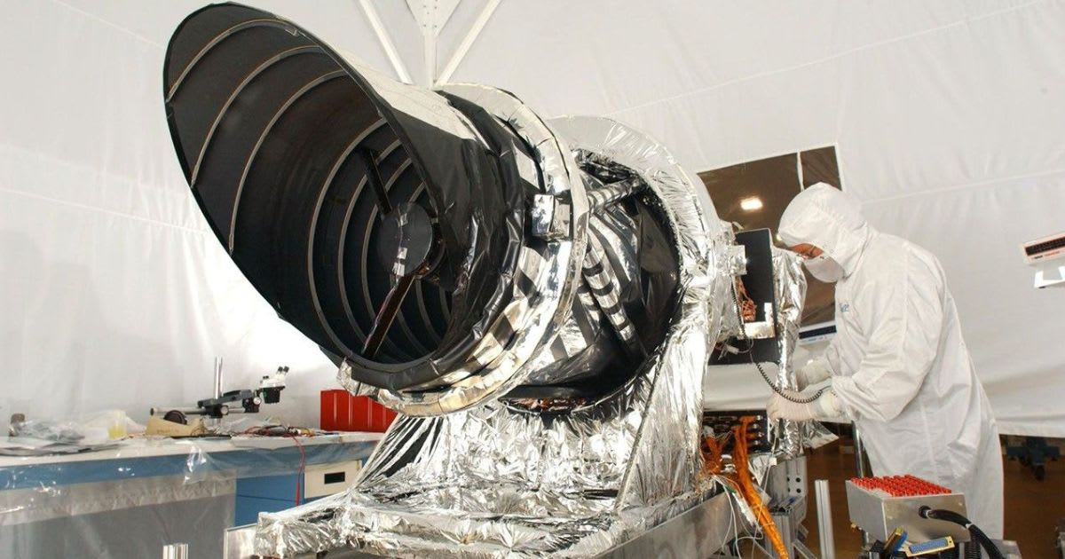
According to NASA, the HiRISE camera that operates in visible wavelengths is also able to capture near-infrared images to identify mineral groups present on the Martian surface. Moreover, from an altitude that varies between 125 and 250 miles above the planet, the camera can resolve surface features measuring 4-8 feet across by acquiring individual "basketball-size" pixel elements. What makes the latest image extra special? A high school student suggested the target through the HiWish program, where anyone can propose places on Mars to be photographed. The HiRISE team at the University of Arizona in Tucson picks the best ideas and turns them into real images.
They even make 3D models so you can watch virtual flyovers online. Shane Byrne, the camera’s principal investigator at the University of Arizona, added: “Rapid data releases, as well as imaging targets suggested by the broader science community and public, have been a hallmark of HiRISE. One hundred thousand images just like this one have made Mars more familiar and accessible for everyone.”
MRO has been up there far longer than many people realize, steadily sending back pictures that make a distant planet feel almost close enough to touch. A hundred thousand images later, it’s still going strong, turning a cold, dusty world into something we can all explore from our computers.
More on Starlust
NASA's Perseverance Mars Rover strikes gold, discovers a trove of ancient rocks on Jezero Crater
NASA loses contact with MAVEN orbiter as it goes silent behind Mars