All you need to know about powerful new U.S.-India satellite NISAR ahead of its launch

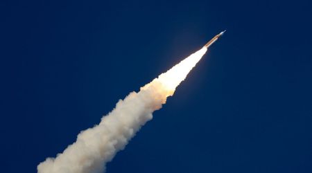
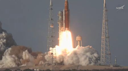
A groundbreaking joint mission between the United States and India is poised for liftoff, with the NASA-ISRO Synthetic Aperture Radar (NISAR) satellite targeting a launch readiness date as early as Wednesday, July 30, 5:40 p.m. IST (8:10 a.m. EDT), as per ISRO on X. This collaborative endeavor, hailed by President Donal Trump and Prime Minister Modi as a landmark in civil space cooperation, promises to usher in a new era of Earth monitoring, as mentioned on NASA.
🌍 Historic Launch Ahead: ISRO Set to Launch NISAR, a joint satellite with NASA !
— ISRO (@isro) July 21, 2025
🚀 On July 30, 2025 at 17:40 IST, ISRO’s GSLV-F16 will launch #NISAR, the first joint Earth observation satellite by ISRO & NASA, from Sriharikota.
🛰️ NISAR will scan the entire globe every 12… pic.twitter.com/4Mry076XSZ
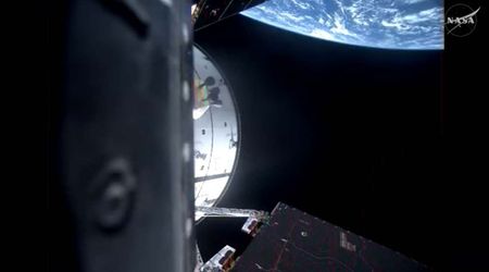
The advanced Earth-observing satellite, developed by the Indian Space Research Organisation (ISRO) and NASA, will depart from ISRO's Satish Dhawan Space Centre aboard an ISRO Geosynchronous Launch Vehicle. NISAR is distinguished as the first satellite to incorporate both L- and S-band radar systems. NISAR's primary objective is to conduct comprehensive scans of nearly all of Earth's land and ice surfaces, repeating these observations every 12 days. Its sophisticated radar technology will enable detection of minute surface changes, down to fractions of an inch. This unprecedented capability will provide crucial insights into shifts in terrestrial ecosystems, the expansion and contraction of ice formations, and tectonic movements within the Earth's crust.
LIVE: We're giving a preview of the upcoming NISAR (NASA-ISRO Synthetic Aperture Radar) mission, the most advanced Earth-observing radar satellite we've ever launched. Tune in to the news conference and share your questions for the team with #AskNISAR: https://t.co/z4Aq181Fhp
— NASA (@NASA) July 21, 2025
The mission's dual synthetic aperture radars will penetrate clouds and light rain, allowing for continuous, day-and-night monitoring. This will prove invaluable for tracking areas prone to earthquakes and landslides, and for precisely measuring the dynamics of glaciers and ice sheets, including unparalleled coverage of Antarctica, according to NASA's Jet Propulsion Laboratory. Data generated by NISAR is expected to have broad applications, from enhancing disaster response and infrastructure monitoring to informing agricultural decisions. Specifically, the satellite's ability to identify subtle surface deformations could aid in predicting volcanic eruptions, assessing earthquake risks by differentiating between slow fault movements and locked segments, and evaluating the stability of critical infrastructure like dams and levees over time.

NISAR's main body, approximately the size of a pickup truck, houses the dual-radar payload: a 10-inch L-band system and a 4-inch S-band system. These distinct radar wavelengths are designed to detect varying land and ice features, providing comprehensive data on attributes such as moisture content, surface roughness, and motion. This dualband approach marks a significant advancement over previous SAR missions. Engineers from ISRO's Space Application Centre in Ahmedabad developed the S-band radar, while NASA's Jet Propulsion Laboratory (JPL) in Southern California was responsible for the L-band radar. The satellite's instruments were integrated with a modified ISRO 13K spacecraft bus and rigorously tested before its transfer to the launch site in May 2025.

This mission is projected to generate an immense volume of data, approximately 80 terrabytes daily, which will be processed, stored, and distributed via cloud infrastructure, ensuring universal accessibility. This wealth of information, especially the L-band radar's ability to penetrate forest canopies and the S-band radar's suitability for crop monitoring, will allow researchers to track changes in forests, wetlands, agricultural zones, and permafrost with striking detail and frequency.
The NISAR mission is a testament to international collaboration, with responsibilities divided between key institutions. NASA's Jet Propulsion Laboratory (JPL), managed by Caltech in Pasadena, spearheaded the US contribution, providing the critical L-band SAR, alongside the radar reflector antenna, a deployable boom, and essential communications and data handling subsystems. The L-band data will be received via NASA's Goddard Space Flight Center, which manages the Near Space Network, as mentioned on JPL.
NISAR is set to launch next week 🚀
— NASA JPL (@NASAJPL) July 23, 2025
Here are 5 things to know about the mission that will track big and small changes across Earth’s land and ice surfaces, helping decision makers stay ahead of natural hazards: https://t.co/2JBAkDR5e0 pic.twitter.com/4TAGeXPLs1
On the indian side, the ISRO Space Applications Centre developed the S-band SAR, while the U R Rao Satellite Centre supplied the spacecraft bus. Launch services will be provided by the Satish Dhawan Space Centre using a rocket from the Vikram Sarabhai Space Centre, with ISRO Telemetry Tracking and Command Network handling satellite operations. The National Remote Sensing Centre will manage S-band data reception and product dissemination.