NASA and ISRO's collaborative satellite delivers groundbreaking first radar images of Earth surface
The joint U.S.-Indian NASA-ISRO Synthetic Aperture Radar (NISAR) satellite has successfully beamed back its inaugural radar images of Earth’s surface, marking a significant milestone ahead of its full science operations launch scheduled for later this year, according to NASA. The initial images demonstrate the mission's capacity to provide high-resolution, actionable data across critical sectors, including disaster response, infrastructure monitoring, and agricultural management.
Fresh views from space 🌍
— NASA JPL (@NASAJPL) September 25, 2025
NISAR has released preliminary radar images that show its ability to distinguish between different land cover. Launched in July, the NASA-ISRO satellite tracks changes big and small on Earth’s land and ice surfaces. https://t.co/2EiWDt7S6Y pic.twitter.com/7XmersYG7J
"NISAR’s first images are a testament to what can be achieved when we unite around a shared vision of innovation and discovery,” stated acting NASA Administrator Sean Duffy. "NASA will continue to build upon the incredible scientific advancements of the past and present as we pursue our goal to maintain our nation’s space dominance through Gold Standard Science.”
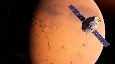
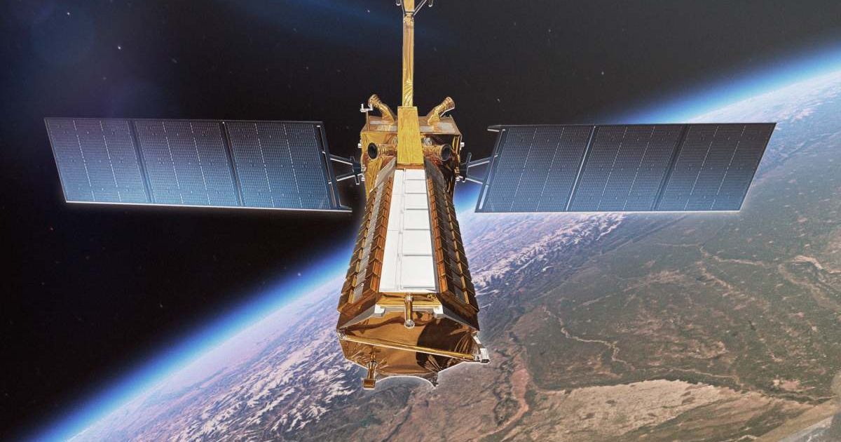
The spacecraft, launched by the Indian Space Research Organisation (ISRO) on July 30, utilizes an L-band synthetic aperture radar (SAR) system, provided by NASA's Jet Propulsion Laboratory. This system, capable of resolving objects as small as 15 feet (5 meters), allows the satellite to see through forest canopies and measure changes in soil moisture and surface movement. This capability is key to monitoring seismic activity, volcanic eruptions and landslides.
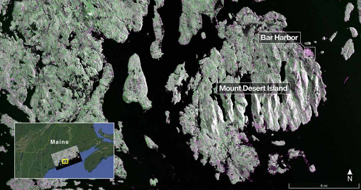
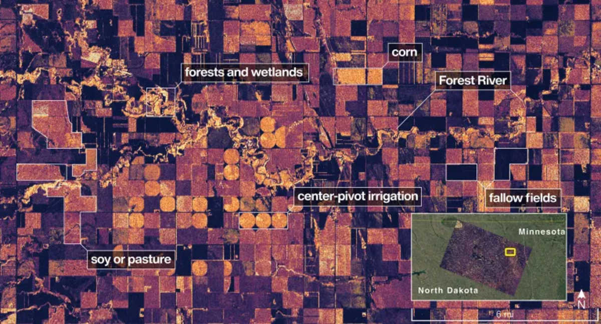
Data captured in August provided two distinct views. On August 21, the system imaged Mount Desert Island on the Maine coast, clearly distinguishing between water (dark areas), forests (green), and human structures (magenta). Two days later, a scan of northeastern North Dakota highlighted subtle variations in farmland, with circular patterns indicating center-pivot irrigation and color differences revealing the presence of crops versus fallow fields. These initial results underscore the L-band SAR's vital role in global environmental monitoring, from tracking the gain and loss of crucial forest and wetland ecosystems to charting the progress of worldwide agricultural production.
NASA Associate Administrator Amit Kshatriya emphasized the broader implications, stating, “By understanding how our home planet works, we can produce models and analysis of how other planets in our solar system and beyond work as we prepare to send humanity on an epic journey back to the Moon and onward to Mars.” NISAR is the first satellite to incorporate both L-band (U.S.) and S-band radar (India) systems. The S-band radar, provided by ISRO’s Space Applications Centre, uses a 4-inch (10-centimeter) signal, which is more sensitive to small vegetation, making it highly effective for monitoring grasslands and certain types of crops.

The satellite, which was raised to its final 464-mile (747-kilometer) orbit in mid-September, will monitor Earth’s land and ice surfaces every 12 days. This work is executed using its 39-foot (12-meter) wide drum-shaped antenna reflector, the largest NASA has ever flown. The mission is the culmination of years of technical and programmatic collaboration, building on a strong heritage of U.S.-India space cooperation. The successful deployment and initial imaging phase of NISAR serve as a powerful testament to international scientific collaboration. The mission's complex architecture was made possible through a strategic division of key responsibilities between leading institutions in both nations.
More on Starlust
A look at NASA-ISRO’s billion-dollar 'first-of-its-kind satellite' NISAR in numbers
All you need to know about powerful new U.S.-India satellite NISAR ahead of its launch