Martian craters reveal long term decline in water on the Red Planet, new study claims
A new scientific investigation, detailed in the Geology journal, has unearthed compelling evidence from the depths of Martian craters, suggesting the Red Planet's abundant water reserves have been on a steady decline for hundreds of millions of years, as per Phys.org.
Scientists have long sought to understand the mechanisms behind Mars' transition from a potentially water-rich world to the arid landscape observed today. This study offers a frozen, chronological record, revealing a history of recurrent ice ages where the total volume of deposited ice progressively shrank. The research, led by Associate Professor Trishit Ruj of Okayama University, Japan, alongside a team including Dr. Hanaya Okuda, Dr. Hitoshi Hasegawa, and Professor Tomohiro Usui, focused on glacial landforms within craters between 20∘N and 45∘N latitude. Their work reconstructed the planet's water storage and loss mechanisms over time.
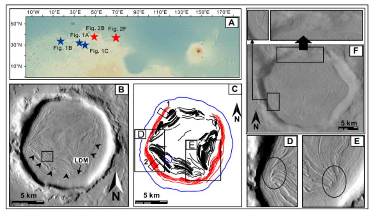
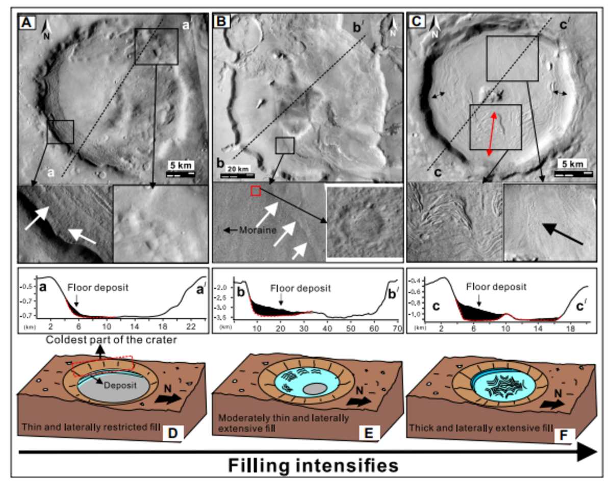
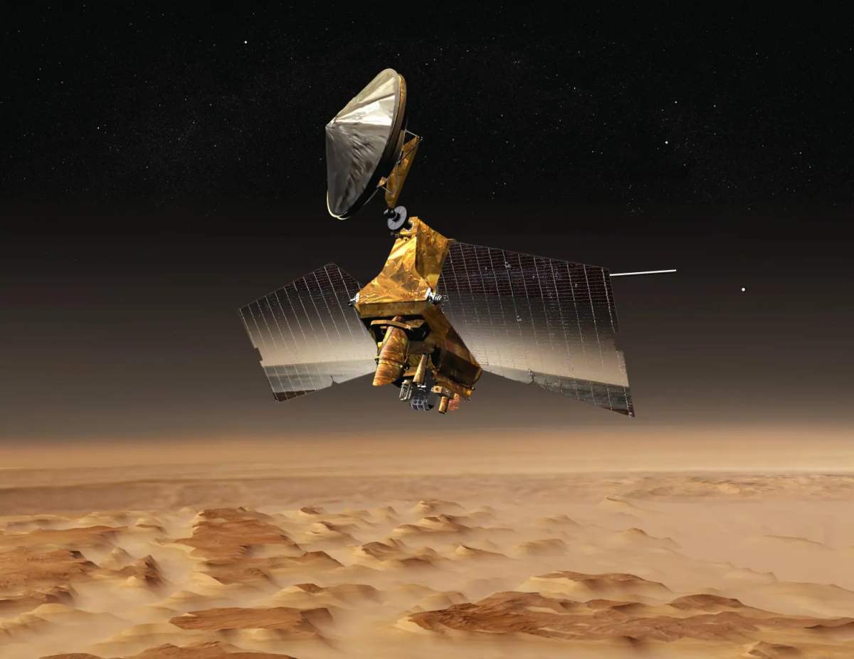
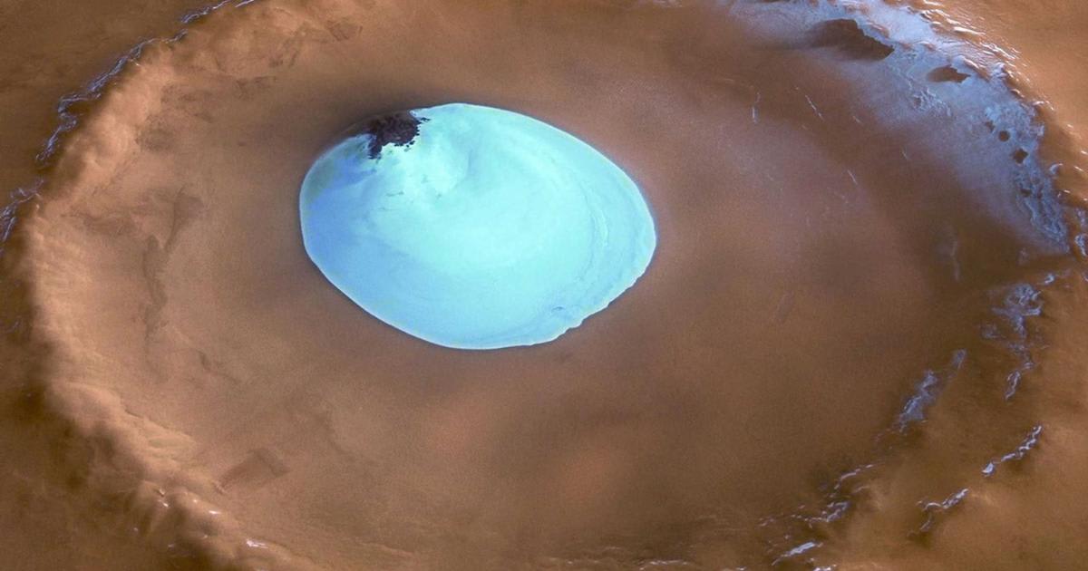
By analyzing high-resolution imagery from NASA's Mars Reconnaissance Orbiter, the team identified tell-tale signs of glaciation, such as moraines (glacial debris piles) and distinctive brain terrain (a pitted, maze-like surface). The images showed ice consistently congregating on the colder, shaded southwestern walls of these craters, a pattern consistent across various glacial epochs spanning from approximately 640 million to 98 million years ago.
The central finding is that Mars experienced multiple, cyclical ice ages. Unlike Earth, Mars' axial tilt (obliquity) undergoes dramatic shifts over millennia, which trigger these cycles of ice accumulation and melt by drastically redistributing solar energy. However, as Dr. Ruj noted, the volume of ice deposited during each of these repeated cycles steadily diminished. These craters, acting as "time capsules," not only document the planet's gradual desiccation but also pinpoint key locations for potential future resource extraction.
The significance of these findings extends to both space exploration and terrestrial climate science. The detailed mapping of these long-lived ice deposits is crucial for in-situ resource utilization (ISRU), a concept vital for sustaining human missions. Buried ice could be harvested for drinking water, converted to breathable oxygen, or split into hydrogen and oxygen for use as rocket fuel, as Professor Usui highlighted. This ability to "live off the land" would be transformative for making long-duration crewed missions to Mars more feasible and cost-effective, as mentioned by the outlet.
Furthermore, the study provides a planetary-scale analogue for climate change. According to Dr. Hasegawa, Mars functions as a "natural laboratory" for observing how vast water systems respond to long-term environmental shifts. The advanced imaging and modeling techniques deployed in this Martian research can be applied to monitoring terrestrial phenomena, such as melting glaciers, permafrost, and hidden water reservoirs on Earth, helping scientists sharpen their understanding of our own planet's changing climate. In essence, the evidence of multi-stage glaciations paints a vivid picture of a planet that once alternated between periods of icy abundance, only to witness its frozen reserves inexorably diminish, a history that offers critical lessons for charting humanity’s future both on Earth and beyond.
More on Starlust
Mars like you've never seen: Surreal images from NASA's Perseverance rover
Mars has one more thing in common with Earth—scientists finally resolve a longstanding mystery
NASA discovers rocky lumps in the Mars mantle, evidence of a violent past with impacts and quakes